
by Prof Christine Gommenginger (PI; National Oceanography Centre)
SEASTAR is an innovative satellite mission concept to measure small-scale ocean dynamics and vertical processes in coastal, shelf and polar seas. The concept has been developed by the National Oceanography Centre (NOC) in partnership with Airbus UK, with support from the SEASTAR science team. SEASTAR was submitted to the ESA Earth Explorer 11 call for mission ideas in December 2020. This Executive Summary is a deliverable of the EE11 SEASTAR project that supported NOC and Airbus UK during the preparation of the EE11 proposal, funded by the UK Space Agency through the Centre for Earth Observation Instrumentation (CEOI).
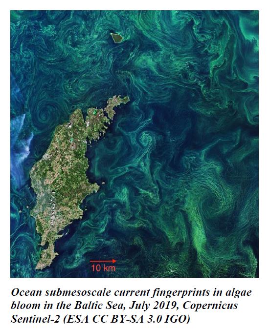
Scientific drivers – High-resolution satellite images of sea surface temperature and ocean colour reveal an abundance of ocean fronts, swirls, vortices and filaments at horizontal scales below 10 km that permeate the global ocean, especially near mesoscale jets and eddies, in coastal seas and close to sea ice margins. These small-scale ocean features are the fingerprints of dynamic atmosphere-ocean interactions and intense ocean vertical processes that mediate exchanges across all the fundamental interfaces of the Earth System – between the atmosphere, the ocean surface, the ocean interior, the cryosphere and land –and impact major aspects of the global climate system.
Today, numerous research studies and high-impact publications confirm the key role of small-scale surface processes in air-sea interactions, upper-ocean mixing, lateral transports and vertical exchanges with the ocean interior. Submesoscales are one of few conduits able to rapidly exchange properties between the turbulent air-sea boundary layer and the ocean interior, representing critical connections within the global Earth System for the uptake by the ocean interior of climate-critical properties (heat, mass, CO2) and the replenishment of surface layers with nutrient-rich deep waters that sustain marine ecosystems and the ocean food chain.
Small-scale processes also visibly dominate in coastal, shelf seas and polar seas. These regions host numerous human activities and natural resources and have disproportionally high strategic and societal value. Small-scale ocean dynamics shape the pathways, dispersion and lateral transports of terrestrial freshwater, nutrients, oil, plastics and other pollutants, all highly relevant to natural habitats, the economy and society.
Mission objectives – SEASTAR is a new Earth Explorer mission concept dedicated to observing small-scale ocean surface dynamics in coastal seas, continental shelf seas and Marginal Ice Zones (MIZs). SEASTAR proposes to measure two-dimensional vector fields of total surface current vectors (TSCV) and ocean surface vector winds (OSVW) and is the first mission to offer the sensitivity, fine resolution, high accuracy, wide swath and flexible sampling to observe and characterise these small-scale phenomena. Using highly innovative technology on a single independent satellite, SEASTAR will, for the first time, quantify these fast-evolving processes on daily to multi-annual scales, across different ocean conditions and latitudes, over all coastal and shelf seas and MIZs.
Technical concept – SEASTAR consists of a single instrument on a single satellite flying in sun-synchronous Low-Earth Orbit. SEASTAR is the first single-platform Ku-band SAR system dedicated to squinted along-track ocean interferometry from space. The payload features two squinted SAR beams pointing ±45° in azimuth fore and aft of the satellite plus a standard SAR beam broadside with multi-polarisation capability (VV/VH, HH/HV). This innovative approach makes it possible to retrieve both components of the ocean surface current vector and the wind vector simultaneously in a single pass, with fine resolution and high accuracy.
SEASTAR produces a single-sided 150km swath. The squinted beams mid-swath incidence angle is 35 degrees. The inherent spatial resolution of the SAR images is 28 x 20 metres (range x azimuth) resulting in Level 2 products for ocean surface current vectors and wind vectors at 1km resolution over the full swath. Accuracy requirements at 1 km resolution for TSCV (0.1 m/s) and OSVW (1 m/s) are demonstrated achievable with the proposed instrument specifications and bespoke Level 2 geophysical inversion.
The choice of microwave frequency and interferometric baseline ensure high sensitivity across the wide swath in all sea state conditions, including sheltered coastal regions. The single-satellite configuration makes SEASTAR the first mission to offer squinted ATI from space to deliver the fine spatial resolution, high accuracy, sensitivity, wide swath and flexible space-time sampling needed to satisfy the scientific requirements of the mission.
Characterising the space/time variability of small-scale dynamics – SEASTAR features two mission phases: a fast revisit of 1-2 days that will reveal, for the first time, the daily variability of small-scale ocean dynamics in a variety of conditions and latitudes; and a slow-drifting long-repeat orbit with a 35 days revisit cycle and 1-day sub-cycle, that will sample, for the first time, small-scale ocean dynamics in all coastal, shelf seas and MIZs over the mission lifetime. This remarkable combination of orbits gives SEASTAR the flexibility to deliver the daily-repeat and systematic spatial coverage needed to address the mission’s scientific objectives. This space-time sampling of TSCV and OSVW cannot be achieved by any other mission or proposed concept at present (e.g. EE10 HARMONY).
Heritage, feasibility, innovation and risk – SEASTAR builds on extensive knowledge and heritage from SAR, scatterometry, ATI and squinted ATI (e.g. Dual-Beam Interferometer, ESA Wavemill, ESA OSCM, Tandem-X). The level of maturity is high, with both SRL and TRL in line with EE11 requirements. Level 0 to Level 2 processing and End-to-End simulators are in place and validated. SEASTAR’s two-beam squinted interferometry principle was successfully demonstrated with data from the Wavemill airborne proof-of-concept campaign over the Irish Sea. Retrieved TSCV maps were validated against independent HF radar data, with retrieval errors that satisfy SEASTAR’s scientific requirements. Further airborne trials are expected in 2021 with the three-look OSCAR airborne system currently under final testing stages for ESA.
The SEASTAR instrument design uses a simple architecture based on a centralised power source and a passive antenna. Whereas Leaky Wave Antenna and Traveling Wave Antenna are well-known and established techniques, SEASTAR would be the first time that such technologies are used on a European satellite mission. The antenna, at 22.5m total length, uses innovative manufacturing that reduces antenna mass compared to traditional construction, whilst satisfying performance requirements. Its novel design offers unique European Earth Observation satellite antenna capability. The development of the required Ku-band technology would also advance and mature technology in ESA member states.
The SEASTAR mission is considered technically feasible; the satellite concept has healthy margins with respect to the launcher mass capability (35%), propellant volume with respect to tank capacity (18%), data downlink to Kiruna ground station (41%) and power (margin percentage dependent upon science operational scenario defined). Careful costing by the experienced industrial team shows that SEASTAR is fully compliant with the EE11 cost envelope, thus allowing this novel squinted SAR instrument to be flown in space for the first time to provide outstanding new Earth Observation capability to study small-scale ocean surface dynamics.