
Lead Organisation: Cranfield University
Project Lead: Steve Hobbs
Partners: University of Birmingham
This study evaluated the feasibility of carrying out passive bistatic geosynchronous radar imaging using comsat transmissions. In this configuration, the transmitter and receiver are both in geosynchronous orbit with inclination and eccentricity small enough to stay near their allocated position but large enough to create a useful synthetic aperture.
Geosynchronous radar has significant potential for new EO services to monitor Earth system processes and respond to disasters. Previous studies have identified many potential mission designs, but there remain risks to mission implementation (technical and applications) so that direct investment in a full mission is uncertain. Low-cost alternatives to demonstrate the concept and retire risks are attractive. A passive bistatic configuration could be implemented relatively cheaply and is evaluated in this study.
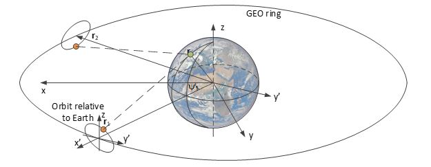
The concept uses a transmitter of opportunity in geosynchronous orbit (e.g. broadcasting satellite TV signals). Provided the transmitted and received signals can be accurately synchronised, a receiver mounted on a separate satellite can use the reflected signals, which contain information about the Earth’s surface and the overlying atmosphere, to form a radar image. Signal processing is done on the ground.
The study team has evaluated system designs (potential user requirements and mission concepts), and the technology of passive bistatic radar exploiting software-defined receivers. A strength of geosynchronous radar is its temporal resolution: in principle it could image processes happening over minutes to hours – far better than conventional satellites in low Earth orbit can achieve. User requirements range from ground motion related to earthquakes and volcanoes at 20 m resolution to atmospheric humidity maps at about 1 km, with time resolution from 15 min (meteorology) to 24 hr (slow ground motion).
Transmissions from satellites now almost all use digital formats, and tend to use higher power and bandwidth than before. This is excellent for radar imaging since radar typically requires signals with high bandwidth and without repeating patterns embedded – the digital signals are very similar to random noise, which is ideal. Suitable transmissions are available in L-band (data links, 20 cm wavelength), Ku-band (satellite TV, 2.5 cm wavelength) and Ka-band (data links, 1.5 cm wavelength). Since broadcast signals cover wide areas, the power density is lower than for a dedicated radar and therefore it is difficult to collect enough signal power for useful fine spatial resolution images. Calculations suggest that a practical passive bistatic radar could form useful images with a resolution around 1 km.
The key findings are that suitable transmissions with stable signal formats and good availability are available in L and Ku-band, and that commonly-used digital signal formats provide good waveforms for radar imaging. The low power density of these transmissions make fine spatial resolution difficult to achieve, but there are valuable applications (e.g. atmospheric humidity mapping for meteorology, soil moisture measurement) requiring spatial resolution around 1 km which seem feasible.
A passive bistatic geosynchronous radar mission is feasible and useful, and that it could be implemented for a cost of around £10M. Other passive bistatic radar implementations are also possible, for example using high altitude pseudo-satellites (aircraft or balloons at 20-30 km altitude) and could provide finer resolution at lower cost, but only for limited areas. These concepts have the potential for valuable services which could be implemented at modest cost, and which would significantly improve the ability to study Earth from space.